Mostly no. We ran all 958 parcels inside the two recorded Porters Neck Plantation plats against New Hanover County’s flood layer on November 8, 2026, and 66 of them, about 7 percent, sit in a FEMA special flood hazard area, all of it Zone AE with a base flood elevation of 13 feet.
The rest of the community is not in a mapped high-risk zone. Seven hundred thirty-four parcels came back Zone X, the minimal-hazard designation, and another 158 landed in the 0.2 percent annual chance band, which people call the 500-year floodplain. That means most Porters Neck Plantation buyers will not be required to carry flood insurance, and a small number on the creek side will.
We get this question more than almost any other about this neighborhood, usually from buyers moving in from somewhere that does not have a hurricane season. The honest answer is that the flood question here is an address question, not a neighborhood question. Two houses on the same street can land on different sides of the line, and the house you are touring may be the one that does.
What the county map actually shows inside the gates
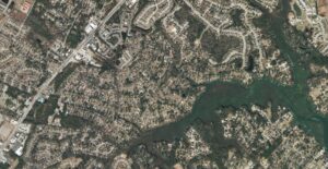
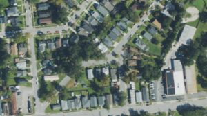
Porters Neck Plantation is not one plat. New Hanover County’s GIS records two recorded subdivision polygons under that name, one with 841 lots and one with 68, and the 2026 tax roll carries 958 parcels inside them. We tested every one of those parcel points against the county’s FloodHazards_2025 layer, which carries the effective FEMA maps, and then checked a sample against FEMA’s own National Flood Hazard Layer to make sure the two agreed. They did.
- 958 parcels inside the two recorded Porters Neck Plantation plats, 880 of them with a house on them New Hanover County GIS Subdivisions and PropertyOwners layers, 2026 tax roll, queried November 8, 2026
- 734 parcels in Zone X, 158 in the 0.2 percent annual chance band, 66 in Zone AE New Hanover County GIS FloodHazards_2025 layer, point-in-polygon at all 958 parcel points, November 8, 2026
- Base flood elevation on every AE parcel in the community: 13 feet New Hanover County GIS FloodHazards_2025, November 8, 2026
- Among the 880 parcels with a house: 681 Zone X, 146 in the 0.2 percent band, 53 Zone AE Same query, November 8, 2026
- Governing map: FIRM panel 3720317900K, effective August 28, 2018 FEMA National Flood Hazard Layer, queried November 8, 2026
Read the 0.2 percent number carefully, because it is the one that confuses people. A property in that band is outside the special flood hazard area. No lender will force you to buy a policy for it. It is still land that FEMA has modeled as flooding in a rare event, and insurers know that, so we tell buyers in that band to get a quote rather than assume the answer is zero.
Which streets are the ones to check
The AE parcels are not scattered evenly. They follow the water, which in this community means the northern edge along Futch Creek and the low ground that runs back from it toward the golf course.
Of the 66 AE parcels, 21 are on Futch Creek Road. The rest are a handful each on Fazio Drive, Saltwood Lane, Vintage Club Drive, Creekside Lane and Galloway National Drive, with one or two on Thornblade Circle, Winged Foot Lane, Mahogany Run, Champion Hills Drive, Windstar Lane, Decoy Lane, Wild Dunes Circle and Congressional Lane.
The 0.2 percent band covers more ground and more streets: Futch Creek Road again with 31 parcels, then Windstar Lane and Wild Dunes Circle with 14 each, Champion Hills Drive with 13, Creekside Lane with 11, Saltwood Lane with 9, and smaller counts on Fazio Drive, Vintage Club Drive, Thornblade Circle, Mahogany Run, Lake Nona Lane and Saint Ives Place.
If you are shopping the interior of the plantation, on the streets that sit well back from the creek, the map says minimal hazard and the paperwork is simple. If you are shopping the creek side because you want the view, plan on the flood conversation being part of your due diligence rather than an afterthought.
What a flood zone actually changes about buying here
Three things change, and they are not equally expensive.
First, insurance becomes mandatory rather than optional. Federal law requires flood insurance on a federally backed mortgage when the building sits in a special flood hazard area, and your lender will verify the zone with a flood determination before closing. In Zone X and in the 0.2 percent band, a policy is your choice.
Second, the premium moves. FEMA publishes its own policy data, and for ZIP 28411, which covers all of Porters Neck Plantation, the gap between zones is real but smaller than most buyers expect.
- Median annual NFIP premium in ZIP 28411, Zone AE: $963 across 797 policies FEMA OpenFEMA NFIP Policies dataset, policies effective on or after November 1, 2025, queried November 8, 2026
- Median annual NFIP premium in ZIP 28411, Zone X: $656 across 726 policies Same dataset, November 8, 2026
- 2,322 NFIP policies in force in ZIP 28411 with effective dates in that window Same dataset, November 8, 2026
That is roughly $300 a year between the two zones at the median, which is not the number that scares people when they hear the words flood zone. The premiums that run into the thousands in this ZIP belong to older, lower-elevation buildings, not to the typical Porters Neck Plantation house.
Third, an elevation certificate starts to matter. Under FEMA’s Risk Rating 2.0 pricing, the certificate is no longer required to buy an NFIP policy, but the elevation of the lowest floor still drives the rate, and a certificate that shows the house sitting well above the base flood elevation is worth having. Ask the seller whether one exists before you pay for a new one. On a 1990s golf-community house that was built to the code of its day, it often does.
How this compares to the rest of the county
Seven percent is low for a community this close to the Intracoastal Waterway. When we ran the same point-by-point test inside the Village of Bald Head Island for our island guide, 714 of 921 points, or 77.5 percent, came back inside a special flood hazard area. Porters Neck Plantation sits on higher ground than its address suggests, and that is most of the reason the answer here is as mild as it is.
The houses are substantial. Across the 880 improved parcels the county roll shows a median heated area of 2,848 square feet on a median lot of 0.36 acres, with a median 2026 appraised value of $762,850. All 958 parcels came back unincorporated in the same tax roll query, outside the Wilmington city limits, so there is no city property tax line on the bill. For the wider picture of what is selling and how fast in this county right now, read our New Hanover County market update, and for the neighborhood itself, our Porters Neck guide.
A flood map is a model, not a promise. The panel governing Porters Neck Plantation took effect in August 2018, which means it predates several of the storms this coast has seen since, and FEMA is working on updated North Carolina mapping that could move lines in either direction. We have also seen houses take water in Zone X here and across the county, usually from stormwater that had nowhere to go rather than from a creek rising. If a house sits at the bottom of a street, ask the neighbors what happens in a heavy afternoon rain, because no flood map answers that question. And if you are buying on Futch Creek Road for the water, understand that the view and the zone are the same thing.
Related questions people also ask
Do I have to buy flood insurance in Porters Neck Plantation?
Only if the house sits in a special flood hazard area and you are using a federally backed mortgage, which covers almost every conventional, FHA and VA loan. In that case the lender is required to verify the zone and require a policy for the life of the loan. If the house is in Zone X or in FEMA’s 0.2 percent annual chance band, nobody will make you buy one, but you can, and in a coastal county we usually think you should.
Does a flood zone lower what a house in Porters Neck is worth?
Not by itself, and not in a predictable amount. What it does is add a carrying cost and shrink the pool of buyers who are comfortable with the paperwork. In practice the houses in this community that command the highest prices are often the ones nearest the water, which are also the ones most likely to be in Zone AE, so the zone and the premium location pull in opposite directions. Price the house, then price the insurance, and look at the total.
How do I find out the flood zone for a specific address?
Pull the official determination rather than relying on a listing portal. FEMA’s Flood Map Service Center will show you the effective panel for any address at no cost, and New Hanover County’s own property and flood viewer shows the same lines over the parcel. Your lender will order a formal determination anyway during underwriting, but you want the answer before you write the offer, not after.
Before you tour anything in Porters Neck Plantation, get the flood zone for the exact address and a real insurance quote to go with it, so you are comparing total monthly cost rather than asking price. If you want the broader picture first, read our Wilmington flood zones and flood insurance guide. When you are ready to put a specific house against those numbers, schedule a consultation and we will run it with you.
Sources: New Hanover County GIS Subdivisions, PropertyOwners (2026 tax roll) and FloodHazards_2025 layers, queried November 8, 2026. FEMA National Flood Hazard Layer, FIRM panel 3720317900K effective August 28, 2018, queried November 8, 2026. FEMA OpenFEMA NFIP Policies dataset, ZIP 28411, policies effective on or after November 1, 2025, queried November 8, 2026. Tidal Realty Partners New Hanover County market update, three months ending September 2026. Tidal Realty Partners Bald Head Island guide, Brunswick County GIS flood hazard layer sampled October 21, 2026. FEMA, mandatory purchase of flood insurance requirement.