Yes, and for most of the island it is the more serious kind of flood zone. Of the 389 taxed parcels addressed on Figure Eight Island, 353 sit inside a FEMA special flood hazard area, and 149 of those carry a VE designation, which means the map expects breaking waves and not just standing water.
Buyers ask us this question about Figure Eight Island more than almost any other place in New Hanover County, usually right after they fall for a house on Beach Road North. It is a fair question and it deserves a parcel-level answer rather than a shrug about the coast. So we pulled the county’s own property records and ran every addressed parcel on the island against FEMA’s National Flood Hazard Layer on November 20, 2026.
What came back is more interesting than a simple yes. The island is not uniformly mapped. The ocean side and both ends sit in VE. A long stretch of the middle sits in AE. And a run of about 35 parcels near the widest part of Beach Road North is mapped outside the special flood hazard area entirely. If you are pricing a house here, which of those three you are buying changes your insurance, your lender’s requirements, and what you can do to the structure.
What the flood map actually says, lot by lot
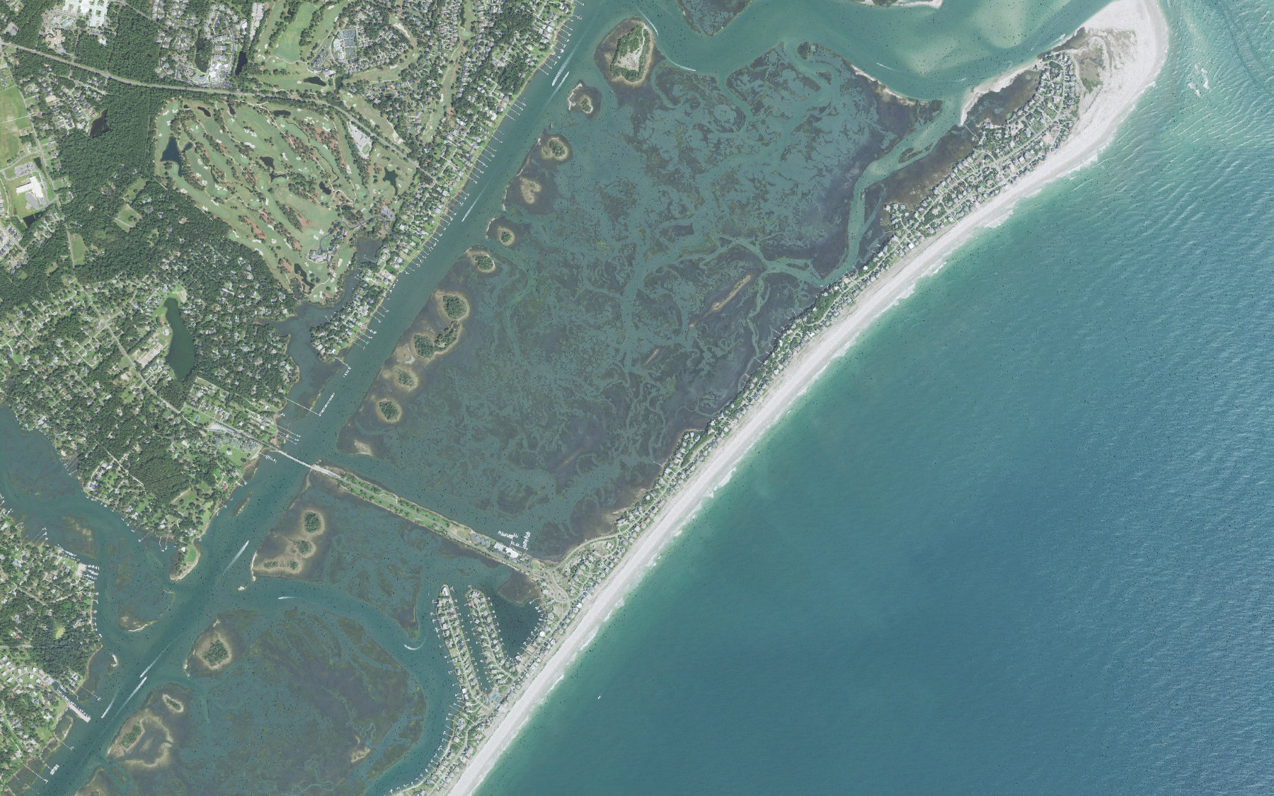
Figure Eight Island is addressed on eight streets: Beach Road North, Beach Road South, Comber Road, Oyster Catcher Road, Inlet Hook Road, Surf Court, Clamdigger Point Road and Dunes Point. New Hanover County’s tax roll carries 389 parcels across those streets. We took the mapped location of each one and asked FEMA’s flood layer what zone it falls in.
- 353 of 389 island parcels fall inside a FEMA special flood hazard area FEMA National Flood Hazard Layer with New Hanover County property records, queried November 20, 2026
- 149 parcels are mapped VE, the coastal high hazard zone, with base flood elevations of 13 to 17 feet NAVD88 FEMA National Flood Hazard Layer, queried November 20, 2026
- 204 parcels are mapped AE, with base flood elevations of 11 to 13 feet NAVD88 FEMA National Flood Hazard Layer, queried November 20, 2026
- 33 parcels sit in the 0.2 percent annual chance band and 2 in minimal hazard Zone X, all of them on Beach Road North FEMA National Flood Hazard Layer, queried November 20, 2026
- The governing map is FIRM panel 3720317900K, effective August 28, 2018 FEMA National Flood Hazard Layer, panel effective date, read November 20, 2026
Those base flood elevations are the number that matters most. A VE 17 lot is being told that the one percent annual chance flood, with waves on top of it, reaches 17 feet above sea level. The house has to be built to clear that, and the insurance is priced against it. An AE 11 lot on the sound side is a different engineering problem and a different premium.
VE or AE: why the single letter changes the house
In an AE zone, the flood expected is water. In a VE zone, FEMA expects waves of three feet or more, which is why VE construction rules are stricter: open foundations on pilings, breakaway walls below the lowest floor, and no enclosed habitable space underneath. That is why the oceanfront houses on Figure Eight look the way they do, and why you cannot simply finish in the ground floor of one.
It also shows up in the quote. Flood coverage in a V zone is the most expensive residential flood risk the National Flood Insurance Program writes, and the private market prices it the same way. If you are comparing two houses here and one is AE 12 while the other is VE 15, you are not comparing like for like, no matter how similar the kitchens look. We walk through what drives those numbers in our Wilmington flood zones and flood insurance guide.
Flood is also only half the coastal insurance bill. Wind and hail on a barrier island are underwritten separately, usually with a named storm deductible calculated as a percentage of the dwelling coverage rather than a flat dollar amount. Our guide to coastal NC homeowners insurance shows what that math looks like on a real coverage amount.
The parcels that are not in the flood zone
The 35 parcels mapped outside the special flood hazard area are not scattered. They run almost continuously from 218 to 320 Beach Road North, with 321 and 420 nearby, in the widest and highest part of the island. Thirty-three of them sit in the 0.2 percent annual chance band, sometimes called the 500 year floodplain or shaded X, and two are in Zone X, minimal hazard.
Here is the part we tell buyers plainly. Being outside the special flood hazard area on Figure Eight does not mean your lender will not want flood insurance, and it certainly does not mean you should skip it. It means the federal map does not require it. The shaded X band exists precisely because FEMA thinks those lots flood, just less often. On an island reached by one private bridge, we would carry the policy regardless of what the map obliges you to do.
What this does to the money
Figure Eight is the most expensive address in the county, and the flood map has not changed that. The county’s 2026 tax roll values the island’s 377 residential parcels at a median total of $5,640,400. The 347 of those that carry a building have a median appraised value of $5,845,000, and the 30 effectively vacant lots carry a median land value of $3,132,000.
- Median total appraised value of the island’s 377 residential parcels: $5,640,400 New Hanover County 2026 tax roll, queried November 20, 2026
- 18 qualifying sales recorded since January 1, 2025, at a median price of $4,805,000 New Hanover County property records, queried November 20, 2026
- The most recent recorded sale was $4,250,000 on Beach Road South, October 16, 2026 New Hanover County property records, queried November 20, 2026
- For scale, the New Hanover County median sale price is $464,000 with 61 days on market Redfin county data, three months ending September 2026, via our New Hanover County market update
Eighteen sales in nearly two years is a thin market. That matters more here than the flood map does for some buyers, because it means appraisals lean on a small set of comparables and a house can sit. You can see how the wider county is moving on our New Hanover County market update, and we go through the second home math in our guide to buying a beach house near Wilmington.
A parcel-level reading is a starting point, not an underwriting decision. Flood zone lines cross lots, so a house can sit in a different zone than the dot on the county map, and what your insurer actually charges turns on the elevation certificate for that structure, not the zone alone. The governing map here was drawn in 2018 and a barrier island does not hold still, so the next map revision can move you. If a house on Figure Eight is genuinely the plan, order the elevation certificate and a real insurance quote during due diligence, before you are committed. If you want the coast without that underwriting exercise, Porters Neck and Ogden on the mainland side are a different conversation, and an honest agent will tell you so.
Related questions people also ask
Does being in a VE zone mean I cannot get a mortgage?
No. Lenders finance homes in VE zones routinely. What a federally backed lender will require is flood insurance for the life of the loan, because the property sits in a special flood hazard area. The practical effect is on your monthly payment rather than on your approval, so ask your lender to include an estimated flood premium in the qualifying numbers before you write an offer rather than after.
Can I add a ground floor room under a house in a VE zone?
Generally no. In a coastal high hazard zone, the space below the lowest floor has to stay unfinished and limited to parking, access or storage, with breakaway walls designed to fail without taking the house with them. Enclosing it as living space puts you out of compliance and can affect both your insurance and your ability to sell. Always check with the county before you plan any work below the elevated floor.
Is Figure Eight Island open to the public?
No. Figure Eight is a private island reached by a single private bridge, with access controlled at the gate. For a buyer that means two things worth planning for. You cannot casually drive out to walk a lot, so showings have to be arranged in advance, and the cost of maintaining private infrastructure is carried by the owners rather than by a municipality.
If a Figure Eight house is on your list, get the parcel’s flood zone, its base flood elevation and its elevation certificate in hand before you fall for the view, then price flood and wind separately with a real quote. We do that work for buyers on this island regularly and can tell you quickly whether a specific address is VE, AE or neither. Bring us the address and we will walk through it with you.
Sources: FEMA National Flood Hazard Layer, FIRM panel 3720317900K effective August 28, 2018, queried November 20, 2026. New Hanover County GIS property records, 2026 tax year, queried November 20, 2026. Tidal Realty Partners New Hanover County market update, Redfin county data, three months ending September 2026.