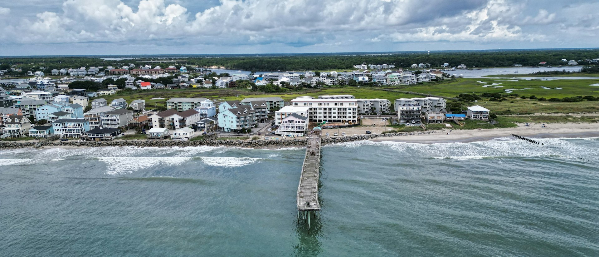
More than half of Carolina Beach sits inside a FEMA high-risk flood zone, and homeowners there have filed 3,039 National Flood Insurance Program claims worth $42.6 million in payouts since 1978. The risk is real and it is mapped, but the costliest flood of the past decade came from rain rather than from storm surge, which is the part most buyers get wrong.
This question usually comes from a buyer who has already fallen for the island and wants to know what they are signing up for. Good. It is a far better question than asking whether the house has ever flooded, because the honest answer on a barrier island is almost always that something nearby has.
So here is what the public record actually says about Carolina Beach, pulled from the two sources that matter: the flood map FEMA publishes, and the claims FEMA has paid.
What the flood map says about Carolina Beach
We sampled the town on a grid of 1,610 points, roughly 60 meters apart, inside the Census boundary of Carolina Beach, and queried the FEMA National Flood Hazard Layer at every one of them on October 23, 2026. The split came back clean.
- Zone AE, the high-risk inland flood zone: 44.0 percent of points, base flood elevations of 10 to 13 feet FEMA National Flood Hazard Layer, queried October 23, 2026
- Zone VE, the high-risk coastal wave-action zone: 10.2 percent of points, base flood elevations of 12 to 17 feet FEMA National Flood Hazard Layer, queried October 23, 2026
- 0.2 percent annual chance band, sometimes called the 500-year zone: 15.8 percent of points FEMA National Flood Hazard Layer, queried October 23, 2026
- Area of minimal flood hazard: 30.1 percent of points FEMA National Flood Hazard Layer, queried October 23, 2026
Add the first two together and 54.2 percent of the town falls in a Special Flood Hazard Area. On any parcel in that zone, a federally backed mortgage requires flood insurance, and the base flood elevation on the map is the number your elevation certificate gets measured against. The VE points cluster along the oceanfront, which is where the map expects breaking waves on top of the water depth, and that is why VE premiums run higher than AE.
The other 45.9 percent of the island is not in the high-risk zone. Read that carefully, because the claims record shows what it does and does not mean.
What has actually flooded here
FEMA publishes every NFIP claim by ZIP code. For ZIP 28428, the file holds 3,039 claims going back to 1978, of which 2,229 were paid, totaling $42.6 million. The median paid claim was $7,971 and the average was $19,106.
The big events are the ones you would expect, and one you would not:
Hurricane Fran in 1996 remains the worst on the record, with 809 claims and $17.0 million paid. Hurricane Floyd in 1999 brought 603 claims and $8.6 million. Hurricane Bonnie in 1998 brought 425 claims and $3.4 million. Hurricane Florence in September 2018, the storm most of our out-of-state buyers ask about, produced 267 claims here and $3.7 million in payments, with a median paid claim of $6,988.
Then there is September 16, 2024. That single day produced 192 claims in this ZIP code, part of 204 tied to the system FEMA logs as Tropical Cyclone Eight. It was a rainfall event, not a named hurricane with a storm surge, and it was the second costliest flood in the town’s claim history at $6.6 million. The median paid claim that year was $21,903, nearly three times the Florence median, and the largest single payment was $370,454.
The mistake buyers make about Zone X
Here is the number we put in front of every Carolina Beach buyer. Of the 213 claims filed in ZIP 28428 during 2024, 69 came from properties rated in Zone X, outside the Special Flood Hazard Area, and those 69 collected $3.67 million. The 136 claims from AE-rated properties collected $2.68 million. Homes the map treats as lower risk took more money out of the program that year than the homes the map treats as high risk.
That is not a flaw in the map. Flood maps model storm surge and riverine flooding. They do not model eighteen inches of rain landing on a flat island with limited drainage in a single afternoon. A Zone X determination means your lender will not require flood insurance. It does not mean water cannot reach your floor.
Across the whole decade the pattern holds: since 2016 the ZIP has produced 523 claims and $10.8 million in payments, and 42 percent of those dollars went to properties rated outside the high-risk zone. We tell buyers to price a preferred-risk flood policy on a Zone X house here rather than skipping coverage, because the premium outside the SFHA is a fraction of what it is inside it.
What living with the risk costs and requires
Three practical things follow from the numbers above.
The policies
Flood is a separate policy from homeowners, and the NFIP caps building coverage at $250,000. On the higher end of this island that leaves a gap you either accept or fill with excess coverage. On the homeowners side, ZIP 28428 appears in the Rate Bureau’s eastern coastal territory, where the Department of Insurance settlement approved increases of 10.5 percent on June 1, 2025 and 10.1 percent on June 1, 2026, while the beach territory covering the barrier islands of New Hanover, Brunswick, Pender, Carteret and Onslow counties took 16 percent and 15.9 percent. Carriers rate by the specific location, so get a written quote on the address rather than the town. Our guide to coastal homeowners insurance covers the named storm deductible, which is the clause that decides what a hurricane actually costs you.
The elevation certificate
On an AE or VE parcel, the elevation certificate is the document that sets your premium, and an older house sitting low can cost multiples of a newer one two doors down. Our Wilmington flood zone guide walks through how to read one and what to do when the seller does not have it.
The bridge
US 421 across Snow’s Cut is the only road link between Pleasure Island and the mainland, as our Carolina Beach community guide lays out. That shapes evacuation, and it shapes the week after a storm when crews are working and everybody is using one crossing. It is an operational cost of living here, measured in time rather than dollars.
None of this tells you whether a specific house will flood. A flood zone is a planning map drawn at a scale that cannot see your lot’s grading, your street’s drainage or whether the previous owner raised the mechanicals. The 2024 event is the clearest proof: the dollars landed where the map said the risk was lower. The honest framing is that Carolina Beach is a barrier island with a real and well documented flood history, and buyers who are comfortable there are the ones who price insurance into the payment from day one rather than discovering it in year three. If that math does not work for you, say so early. Inland Wilmington and Leland carry a fraction of this exposure, and we would rather point you there than talk you onto an island you will worry about every August.
Related questions people also ask
Is Carolina Beach in a flood zone?
Most of it is. Sampling 1,610 points inside the town boundary against the FEMA National Flood Hazard Layer on October 23, 2026, 44.0 percent fell in Zone AE and 10.2 percent in Zone VE, which together make up the Special Flood Hazard Area, while 15.8 percent fell in the 0.2 percent annual chance band and 30.1 percent in an area of minimal hazard. Because the lines run street by street, the only answer that matters is the determination pulled for the specific parcel you are buying.
Do you need flood insurance in Carolina Beach?
If the parcel is in Zone AE or VE and you are using a federally backed mortgage, your lender will require it. If the parcel is in Zone X, no one will require it, and the claims record still argues for carrying it. In 2024, 69 of the 213 flood claims filed in ZIP 28428 came from properties rated in Zone X and they collected $3.67 million. Preferred-risk policies outside the high-risk zone cost far less than policies inside it, which makes that coverage one of the cheaper pieces of protection on the island.
Has Carolina Beach flooded recently?
Yes, and the most recent major event was rain rather than a hurricane. On September 16, 2024, a system FEMA logs as Tropical Cyclone Eight produced 192 flood insurance claims in ZIP 28428 in a single day, part of 204 claims tied to that event and $6.6 million in payments. For comparison, Hurricane Florence in September 2018 produced 267 claims and $3.7 million. The 2024 median paid claim was $21,903 against $6,988 for Florence, so the typical 2024 loss was substantially more expensive.
Before you write an offer on Pleasure Island, have us pull the FEMA flood determination, the elevation certificate if one exists, and a written flood and homeowners quote on that exact address, and do it inside your due diligence period rather than after it. Those three documents turn this whole question from a worry into a number. If you want help reading them against the price, talk it through with our team.
Sources: FEMA National Flood Hazard Layer, 1,610 points sampled inside the Census boundary of Carolina Beach town and queried October 23, 2026. FEMA National Flood Insurance Program claims data for ZIP code 28428, 3,039 claims with losses from 1978 through 2024, data as of September 8, 2026 and retrieved October 23, 2026. FEMA National Flood Insurance Program building coverage limit of $250,000. North Carolina Department of Insurance, 2024 proposed homeowners insurance increase settlement table, Territory 140 approved increases of 10.5 percent on June 1, 2025 and 10.1 percent on June 1, 2026, and Territory 120 at 16 percent and 15.9 percent. U.S. Census Bureau TIGER boundary for Carolina Beach town. Our Carolina Beach community guide for the Snow’s Cut crossing and drive times.