Three things decide whether a Topsail Island purchase works: which flood zone the house sits in, what your actual insurance quote comes back at, and whether the property falls inside the federal coastal barrier unit at the north end, where federally backed flood insurance is not available. Everything else, including price, follows from those three.
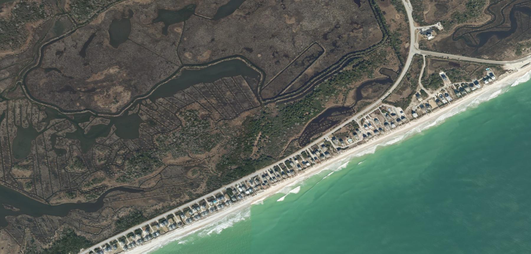
Topsail Island runs 26 miles from New Topsail Inlet up to New River Inlet, and it holds three towns in two counties: Topsail Beach and Surf City in Pender, and North Topsail Beach in Onslow. The towns look similar from the road and behave very differently once you start reading documents.
We represent buyers on this island regularly, and the same handful of surprises come up over and over. Here is the list we work through before anyone falls for a porch.
Start with the flood zone, not the listing photos
On a barrier island the flood zone is not a footnote. It sets your insurance cost, it sets what a lender will require, and in Zone VE it changes how the house has to be built. We ran every parcel in both Pender County towns against FEMA’s flood layer today.
- Topsail Beach: of 1,974 parcels, 1,490 are in Zone AE and 462 in Zone VE, which puts 98.9 percent of the town inside the special flood hazard area FEMA National Flood Hazard Layer and NC OneMap parcels, queried November 17, 2026
- Surf City: of 6,631 parcels, 3,016 are AE and 1,447 are VE, with 1,833 in Zone X, so 67.5 percent sit inside the special flood hazard area FEMA National Flood Hazard Layer and NC OneMap parcels, queried November 17, 2026
- Median total tax value of an improved property: $910,846 in Topsail Beach and $604,207 in Surf City NC OneMap, Pender and Onslow County records, queried November 17, 2026
- Pender County median sale price $499,000, 83 days on market, 430 active listings Redfin county data, three months ending September 2026, via our Pender County market update
The practical reading is this. In Topsail Beach, assume you are buying inside the floodplain and budget accordingly. In Surf City, about a quarter of parcels sit in Zone X, mostly on the mainland side of the town, and those are a genuinely different insurance proposition from an oceanfront VE lot. Our flood zone guide explains what each label does to a policy.
The federal line at the north end that nobody mentions
This is the single most expensive thing a buyer can miss on this island. Part of North Topsail Beach sits inside Coastal Barrier Resources System unit L06, a system unit of 740 acres of fast land and 6.6 miles of shoreline. Our overlay of the unit against the town boundary puts it across 55.9 percent of North Topsail Beach’s area.
Inside a system unit, most new federal financial assistance is withheld, and that includes flood insurance through the National Flood Insurance Program for structures built or substantially improved after the unit’s designation date. Owners there buy private flood coverage instead, which prices differently and is not guaranteed to be available on the terms you want.
Neither Topsail Beach nor Surf City is touched by the unit, which is one reason the three towns do not price alike. If you are looking at North Topsail Beach, get the CBRS determination for the specific parcel in writing before you remove any contingency.
The rest of the due diligence list
Get a real insurance quote during due diligence, not after closing. On the coast you are usually buying three things: a homeowners policy with a wind and hail deductible written as a percentage of your dwelling coverage, flood insurance, and sometimes separate windstorm coverage. We walk through how those deductibles work in our coastal insurance guide, and on an island they are the difference between a workable budget and a bad surprise.
Ask for the elevation certificate. It is the document that tells an underwriter how high the lowest floor sits relative to the base flood elevation, and it can swing a flood premium substantially. If the seller does not have one, you can order it, and on a VE lot it is worth doing before you waive anything.
Understand the oceanfront setback rules. North Carolina’s Division of Coastal Management sets oceanfront construction setbacks from the vegetation line based on the long-term erosion rate measured for that stretch of shoreline, and the inlet ends of the island carry additional inlet hazard rules. If your plan involves rebuilding, expanding or adding a pool, confirm what the CAMA rules allow for that specific lot before you buy, not after.
Check the utilities and the rental rules for the specific address. Water, sewer and septic arrangements are not uniform across the island, and each town sets its own short-term rental rules. If rental income is part of your math, ask for the actual rental history, the management agreement and the town’s current ordinance rather than relying on a projection.
Topsail Island is a wonderful place to own and an expensive place to carry. Insurance, flood coverage, higher maintenance from salt air, and the possibility of a special assessment for beach nourishment all land on top of your mortgage, and they do not move in your favor over time. The island also spans two counties and three towns, each with its own tax rate and its own rules, so figures you read about one town do not transfer to another. Access is a real factor as well: the high-rise bridge at Surf City carries most traffic, and summer weekends back up. If you want the coast without the barrier-island carrying costs, Hampstead and the Scotts Hill corridor put you twenty minutes from the sand with a mainland insurance profile, and we would rather tell you that now than after your first renewal.
Related questions people also ask
Can you get flood insurance on Topsail Island?
In Topsail Beach and Surf City, yes, through the National Flood Insurance Program or a private carrier, and your lender will require it on any property in a special flood hazard area. In the part of North Topsail Beach inside the federal coastal barrier unit, NFIP coverage is not available for structures built or substantially improved after the designation date, so owners rely on private flood policies. Because that line runs through the town rather than around it, the only reliable answer is a parcel-level determination.
What is the difference between Zone AE and Zone VE?
Zone AE is land expected to flood in the one percent annual chance event, while Zone VE is the part of the coast where that flooding arrives with breaking waves. VE carries stricter construction standards, usually requiring the lowest floor to sit on piles above the base flood elevation with nothing solid enclosed beneath it, and it generally costs more to insure. Two houses a block apart can sit in different zones. Always check the map for the specific parcel rather than the street.
Is it better to buy in Surf City or Topsail Beach?
Surf City has more commercial services, a wider range of price points and a share of homes on the mainland side outside the floodplain, which suits buyers who want year-round convenience. Topsail Beach is quieter and almost entirely inside the flood hazard area, with higher typical values and a stronger second-home character. Neither is better in the abstract, and the right answer usually comes down to whether you want a town around you or a quiet dead-end street.
Before you tour, pick the town, then ask for three documents on any house you like: the flood zone determination, the elevation certificate and, in North Topsail Beach, the coastal barrier determination. Our Topsail Beach and Surf City guides cover each town in detail, and the Pender County market update shows where prices and days on market stand this month. Send us the addresses on your list and our team will pull the flood, insurance and parcel records before you spend a weekend driving.
Sources: FEMA National Flood Hazard Layer, every parcel in Topsail Beach and Surf City assigned by centroid, queried November 17, 2026. NC OneMap statewide parcels, Pender and Onslow County records, queried November 17, 2026. U.S. Census Bureau TIGERweb town boundaries for Topsail Beach, Surf City and North Topsail Beach. U.S. Fish and Wildlife Service Coastal Barrier Resources System mapper, unit L06 Topsail, queried November 17, 2026. North Carolina Division of Coastal Management oceanfront setback and inlet hazard area rules. Tidal Realty Partners Pender County market update, Redfin county data, three months ending September 2026.